homepage
rental-offer on the subject "maps" - issue Sunday, December 4th, 2016
279 objects keywords airline to timeprofilm.de, Horst
Decker GbR,
Kirchbergstr.37, D-63691
Ranstadt (40km north of Frankfurt/Main),
Phone: 00496035-921685, Phone/Fax:00496035-1403, St.ID.:81 438 072 592, USt.-Nr. DE - 2258749
|


| order No | in use | description | rental |
|---|---|---|---|
INo 4628 | 1953-1953 | 3-colour time schedule of the Franch airline Air France, map of Europe and North-Africa with icons of all sights under the airways of AF, in French, issue 10 of the 1st of Aug. 1953 | 15 € |
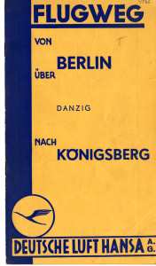
INo 4566 | 1927-1933 | Folder of the German airline Lufthansa, issued around 1930, describing the flight-routing Berlin to Danzig and Königsberg, Lufthansa still written 'Deutsche Luft Hansa', 12 pages 12x21cm, describing all sightseeings on the way, adds | 20 € |
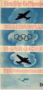
INo 4627 | 1936-1936 | Time table of the German Lufthansa airline, showing it's world wide air network, routes and prices, incl. Zeppelin transportation to USA and flights to Olympic Games Berlin, summer 19th of April to 3rd of Oct. 1936, 3-colour print | 20 € |
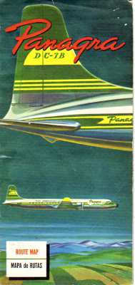
INo 4623 | 1953-1953 | South-American network of the Argentine airline Panagra, face showing 4-enginge DC7B, issue of 1953 | 20 € |
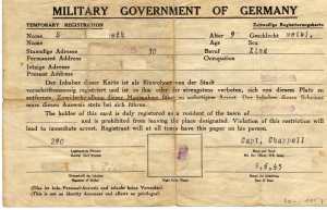
INo 2909 | 1945-1948 | German post WW2 temporary registration, form of the US Occupation Forces, issued in Radevormwald 16th July 1945, printed on the back of a WW2 German Army map of Calais France, 20.5x13cm | 15 € |
INo 8832 | 1987-2000 | German roadmap 'Der Große ADAC Europa Atlas', book with around 360 pages with maps of all European countries, issue 1987, good condition with traces of use. | 10 € |
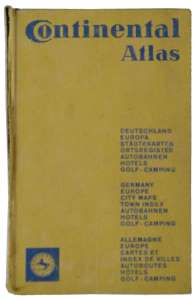
INo 8151 | 1966-1975 | Continental atlas German and Europe, cities, autobahns, hotels and camping areas, issued by the tire plant Continental 1966/67, 530 pages, good condition with traces of use | 10 € |
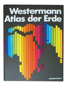
INo 7582 | 1985-1990 | German school-atlas 'Atlas der Erde', Westermann edition of 1985, 205 pages with coloured maps and 56 pages village-index, 30x24cm, very good condition | 8 € |
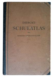
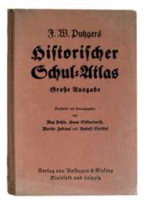
INo 14745 | 1927-1950 | Big German atlas for high schools, 23x36cm, issue 1927, 156 pages, geography, history, politics, resources, people, colonies, good condition | 20 € |
INo 9018 | 1938-1950 | Big German atlas 31x44cm, 140 pages with 213 maps and 79 sketches, register with around 100.00 (old WW2) village names, history, politics, resources, people (anti-Semitic influence), colonies, used condition | 20 € |
INo 5821 | 1966-1975 | Chronicle 'dtv-Atlas zur Weltgeschichte - Band 2' (dtv-atlas of world's history - volume 2), beginning with French revolution until 1974, 9th edition issued Oct. 1974, 325 pages with index | 8 € |
INo 10933 | 1966-1980 | 'Großer Iro Weltatlas' (big Iro Atlas), 25th issue of 1966, blue linen-cover, size 31x44cm, with 110 maps and register, countries, pictures, flags, stars, Germany still in the borders of 1937 | 15 € |
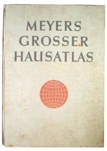
INo 12383 | 1938-1950 | German atlas of 1938, 'Meyers Großer Hausatlas', 140 pages 31x44cm with 213 maps and 79 sketches, register with around 100.000 village-names of WW2 time, history, resources, people (anti-Semitic influenced), colonies, good condition | 25 € |

INo 8833 | 1988-2000 | German road map 'Shell Reiseatlas Deutschland und Europa', red cover with maps and pictures of landscapes, 160 pages, issue 1988/89, good condition with traces of use | 10 € |
INo 6541 | 1952-1960 | German folks atlas 'Unsere Erde' (our Earth), issued 1942 sheet by sheet in a North Bavarian newspaper and assembled by customer, 198 pages (missing 2 index pages) | 12 € |
INo 8405 | 1949-1960 | Book on Paris France, issue 1949, 510 pages in French, showing streetmaps and reproductions of some hundred famous paintings, beige hardcover with golden print | 15 € |
INo 3116 | 1930-1933 | German 'New map of the Folks State Hessen', 4th edition 1930, by Prof. K. Herbert, edition Emil Roth Gießen, scale 1:500000, coloured, 46x32cm, for use in schools, worn condition | 10 € |
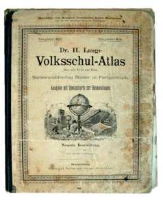
INo 1635 | 1888-1900 | Volksschul-Atlas über alle Teile der Erde - Ausgabe mit Specialkarte zur Heimatkunde - Braunschweig - neuste Bearbeitung 1888, von Dr. H.Lange, 37 Blätter in Farbendruck, 27x21cm, gebrauchter Zustand und Blätter teilweise lose | 20 € |
INo 3083 | 1930-1945 | German booklet 'Der kleine Geograph - H. Harms Billige Atlashefte' (the small geographican - cheep atlases), issue 'Germany', around 1930/40, 6 pages with maps of Germany within the borders of 1937 | 10 € |
INo 6600 | 1941-1945 | German school atlas, edition Adolf Liebers, issue 1941, showing Germany in its largest size of 1940, reaching into Russia to the Bug river, 32 pages, geological, political and industrial, size 29x20cm | 15 € |
INo 6358 | 1935-1960 | 'Columbus Hausatlas in Wort und Bild'(Columbus home atlas in words and pictures), 60 pages with coloured maps (still with borders of 1937), with informations, statistics and prints of landscapes and cities | 20 € |
INo 5603 | 1947-1950 | German atlas for pupils 'Weltatlas für den Schulgebrauch', issued in the US Occupation Zone 16th Apr. 1947 and British Zone 25th Aug. 1948, booklet 23x31cm, 34 pages, by Karl Wenschow GmbH München | 12 € |
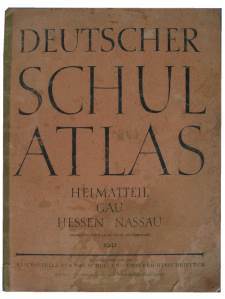
INo 2398 | 1942-1945 | Hessian schoolbook from 1942, 'Deutscher Schul-Atlas' -part Hessian-Nassau, Reichsadministration for School and Schoolbooks, 12 pages with maps, 25x33cm | 15 € |
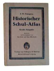
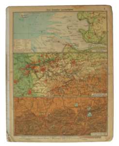
INo 13299 | 1910-1945 | Book about the geography of history, showing the historic countries and the knowledge about geography in former times, from antiquity to modern times, 240 maps, Velhagen & Klasing 1910, brown linen cover, used condition | 20 € |
INo 9922 | 1941-1950 | 'Handkarte des Rhein-Mainischen Wirtschaftsgebietes' (Map of the economic area Rhein Main), Prof. Herbert, 11th edition 1941 of Emil Roth Verlag Gießen, 1:500000, coloured, 46x34cm, edges worn | 10 € |
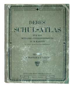
INo 1636 | 1916-1919 | German school atlas for the middle forms, edition Debes 1916, 78 maps with focus on the Brandenburg province, heavily used and pages loose | 10 € |
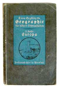
INo 13582 | 1927-1940 | German geography book for high schools, 'Geographie für höhere Lehranstalten, E. von Sedlitz 1931', showing all countries of Europe, except Germany, Austria, Swiss and Netherlands, and many photos of its landscapes, good condition | 10 € |
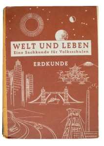
INo 13603 | 1951-1960 | German geography book for basic schools of the German state 'Nordrhein-Westfalen, 'Welt und Leben' (world and life), issued 1951, 128 pages with geography of all the world, good condition | 10 € |
INo 7337 | 1941-1945 | German geography booklet 'Hirts Erdkundliche Arbeitshefte - Europa', volume 2, 21x15cm with 32 pages, around 1941, countries, population, resources, German tribes, fleet and automobiles | 15 € |
INo 8489 | 1927-1940 | German geography book for high schools, 'Geographie für höhere Lehranstalten, E. von Sedlitz 1927', showing all countries of Europe, except Germany, Austria, Swiss and Netherlands, many photos of its landscapes, very good condition | 10 € |
INo 8748 | 1922-1933 | German schoolbook about geography, by Paul Knospe 1922, this 3rd edition 1925, 103 pages, contents deals for 60% Germany rest international, history, geography, economy and politics, good condition | 20 € |
INo 8761 | 1930-1950 | German georgraphic working book by Hagemann, booklet 3 - Europe, 32 pages with blind maps in which the pupils should enter the cities, mountains and rivers, a little use, around 1940 | 10 € |
INo 2458 | 1892-1920 | German school book on geography by E.v.Seydlitz 1892, 21st reprint 1897, 343 pages with maps and wood cuts and 33 sketches of landscapes and house pattern, economy | 20 € |
INo 2529 | 1908-1920 | A5 Heft 'Heimatkunde des Großherzogtums Hessen für hessische Schulen'- Schulrat P.Müller 1908, Geografie und Geschichte Hessens und der einzelnen Landkreise, Einwohnerzahlen, Bodenschätze etc. 32 Seiten | 20 € |

INo 4617 | 1920-1934 | German geography book of the State Hessen, 'Mein Hessenland - Heimatkunde von Hessen-Nassau', issued by the Hessian basic schools teachers association around 1920, 184 pages, missing 4 pages and heavily used | 15 € |
INo 5863 | 1929-1935 | German high-school book on geography, edition Buchner 1929, dealing the German Reich, all its states economy etc, 93 pages, good condition | 20 € |
INo 4334 | 1901-1920 | German school book on history, 'Weltgeschichte für das deutsche Volk', 25th edition 1901, second volume, in German 'history of the old world - the folks of the Greek-Roman period', 576 pages, green linen cover with leather back, used condition | 15 € |
INo 7357 | 1929-1933 | Book about the geography of history, showing the historic countries and the knowledge about geography in former times, starting about 500 before Christ, 167 pages with maps, Pehle & Silberbort 1929 | 25 € |
INo 11378 | 1937-1945 | Book about the geography of history, showing the historic countries and the knowledge about geography in former times, starting at the ice-ages, 160 pages with maps, Pehle & Silberbort 1937, 54th edition | 20 € |
INo 12937 | 1912-1919 | German school atlas, edition Velhagen & Klasing 1912, 49 maps with focus on the city Frankfurt and region, city map, important buildings, memorials etc., heavily used and pages loose | 10 € |
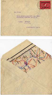
INo 1504 | 1949-1949 | A letter envelope of the German post WW2 period, due to the lack of paper made of a German military map of Russia (Wolga area at Wassilewo), the map print inside, mailed in East Germany 18th May 1949 to Erfurt | 10 € |
INo 4846 | 1957-1957 | Pocket calendar of 1957, issued by Mercedes Benz, 8x12cm, used by the swimming champion Peter Mayer, many personal notes, information on Mercedes cars, engines, service stations, number-shield code, road signs and maps | 10 € |
INo 4848 | 1959-1959 | Pocket calendar of the German airline 'Lufthansa', issue 1959. 8x11cm, showing network, types of used airplanes, diary, used and many notes from the German youth swimming champion Peter Mayr, incl. belonging Lufthansa ball-point pen | 10 € |
INo 4849 | 1957-1957 | Pocket calendar of the BP aviation petrol service 1957, contents consulates in London, currencies, airplane registration codes, airplane models, world wide airline network | 10 € |
INo 4852 | 1958-1958 | Pocket calendar, gift of the Mercedes-Benz Co 1958, 8x12xm, used by the pupil and swim-champion Peter Mayr, many personal entries, history of MB, racing prices, service-stations, licence-plate codes, road-signs, street-maps, traffic rules | 10 € |
INo 464 | 1946-1950 | Cigarette case of polished aluminium, face with contours of Hessia, Bavaria and part of Baden-Württemberg, impressed 'American Zone Germany', around 1946 | 30 € |
|
| |||
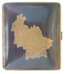
INo 12535 | 1946-1950 | Cigarette case of gold plated brass, face and back brown marbled, face with contours of the European US Occupation Zone, Hessia, Bavaria with rivers and bigger cities, 7.3x8.4x1.4cm, some minor dents in back otherwise like new | 45 € |
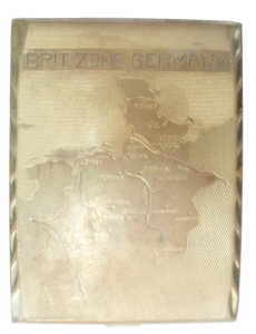
INo 463 | 1946-1950 | Cigarette case of gold plated sheet-brass, face with contours of northern Germany, marked British Occupation-Zone with cities and rivers, engraved 'Brit.Zone Germany', around 1946 | 45 € |
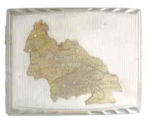
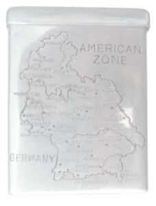
INo 4439 | 1946-1950 | Cigarette case of nickel-plated sheet-brass, face with contours of the southern part of Germany and soldiered on it a map of the US Occupation Zone of Germany, made of brass, back with map of the USA, around 1946 | 45 € |
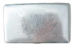
INo 5949 | 1950-1970 | Flat cigarette case of nickel plates sheet-steel, face with contours of Ireland, incl. cities and rivers, 135x80x9mm, around 1950, very good | 20 € |
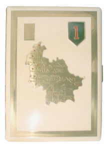
INo 10702 | 1946-1950 | Cigarette case of gold plated sheet brass, face on creme-white background the contours of Hessia, Bavaria and part of Württemberg, right corner badge 'red one' of the 1st US Inf. Division, 12x9x1.2cm, very good condition | 45 € |
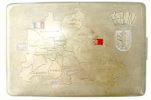
INo 5659 | 1946-1950 | Cigarette case of sheet brass, face with contours of the city German Berlin, divided in 4 occupation sectors, right corner crest of Berlin, inside marked '19.9.1951 - K.W.', 12x8.5x0.8cm | 45 € |
INo 7942 | 1955-1965 | Small sofa cushion, souvenir of Swizzerland around 1955, 26x26cm, white, face with printed on map and views of Swizzerland, back olive, some minor spots on it | 15 € |
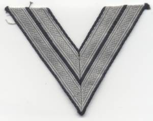
INo 15241 | 1941-1945 | Original rank insignia from a German Wehrmacht's privat first class, double angle, silver stitching on black ribbon for eorking dress, unused condition | 15 € |
INo 6404 | 1938-1938 | Three colour time schedule of the German Lufthansa airline, face showing the FW200 Condor D-AERE/RS JU D-AALU (Der Große Dessauer) in the air, valid from 27th of March 1938, TOBs, European air net, prices and duration of flights | 20 € |
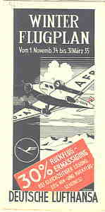
INo 4631 | 1934-1935 | Flight schedule of the German Lufthansa of 1934, bi-colour print, schedule of all connections and post-transfer, terms of business, remark that Lufthansa uses airplanes with heating in wintertime | 20 € |
INo 4632 | 1936-1936 | Time table of the German Lufthansa Airline, listing the routes from Frankfurt-Rebstock airfield, prices and terms, face showing Ju52 over Frankfurt city hall | 20 € |
INo 4633 | 1928-1928 | Bicoulor flight schedule of the German Lufthansa airline, still spelled Luft Hansa, description of the connection Frankfurt - Gießen - Kassel Hannover - Hamburg, explaining route and sights, aicrafts Ju F13 u. G24, issued 1928 | 25 € |
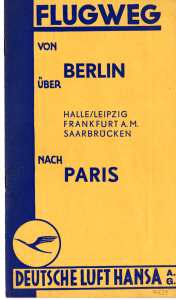
INo 4634 | 1927-1933 | German Lufthansa airling manual 'Flugweg von Berlin over Halle/Leipzig, Frankfurt, Saarbrücken to Paris', discribing the route and the landscapes and objects of interests being overflown, around 1930 | 20 € |
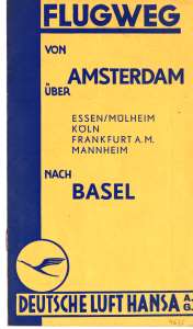
INo 4635 | 1927-1933 | Brochure of the German Lufthansa around 1930, descriping the air route Amsterdam - Essen- Cologne- Frankfurt - Mannheim - Basel', 12 pages 12x21cm, explaining the landscape under wing, ads | 20 € |
INo 5244 | 1937-1937 | Three colour flight schedule of the German Lufthansa, in German 'Summer Time-Schedule 1st issue Apr.-2.Oct.1937', title showing airplane Heinkel Blitz 'D-AXAV', terms, European offices and net with time-table and costs | 20 € |
INo 8081 | 1998-1999 | Time-schedule of the airline 'South African Airways', issue 1st May 1998, 6 pages with promotion, time-table, map and German offices, like new | 8 € |
INo 8229 | 1998-1999 | Flight schedule of the South African Airways, valid from 1st of Aug. 1998, folder with 6 pages 10x21cm, maps and timetable for flights Germany/South Africa and information on the company, like new | 10 € |
2 pieces available INo 10911 | 1962-1970 | Flight schedule of the German airline 'Südflug', with map of all connections, 1965, 61x40cm, good condition | 10 € |
INo 3447 | 1943-1945 | US pilots map L50 'Darmstadt' - Germany 1:250.000 from 1943, showing area from Rüsselsheim to Dinkelsbühl, very good condition, gaze enforced waxed paper | 20 € |
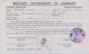
INo 5342 | 1945-1949 | Temporary Registration Military Government of Germany, issued 17th May 1945 (9 days after end of WW2) for political followed of 3rd Reich L. Linné, size 20x12.5cm printed on the back of a German army map of Luxembourg | 15 € |
INo 7704 | 1946-1948 | Personal document of Dean Harold Krasomil, stating, that he is engaged as investigator for the Allied US Military Government over Germany at Starnberg/Germany, dated 6th of Oct. 1947, incl. handmade streetmap | 10 € |
INo 10951 | 1945-1948 | Temporary registration, issued 29th of Sept. 1945 by the US Military Government of Germany on the back of a 20.5x13cm piece of a map of Western France | 15 € |
 INo 1157 | 1945-1948 | Notausweis des 'Military Government of Germany'- Temporary Registration, für ein 9-jähriges Mädchen, 20.5x13cm, auf Rückseite einer Landkarte von Italien gedruckt, ausgestellt in Michelfeld am 06.06.1945 | 15 € |
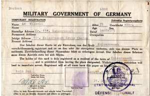
INo 10196 | 1945-1947 | Temporary id, issued in the German post WW2 period on the back of an US pilot's map of Sedan France, bilingual English/German, issued in Kaiseresch 21st of June 1945, US seal 'Statuette of Freedom above war destruction' | 15 € |
INo 12356 | 1945-1949 | Temporary Registration Military Government of Germany, issued 9th June 1945 (1 month after end of WW2), size 21x13cm, printed on the back of a German army map of Riberac France | 15 € |
INo 5114 | 1945-1947 | German temporary registration card, form 20x12cm, English/German, issued in Wuppertal 15th June 1945, US-form, but issued by the British Occupation-Forces, printed on the back of a WW2 German Army map of French Loire-area | 15 € |
INo 832 | 1945-1946 | Formulary of the Allied Military Government of Germany, 20x13cm, temporary registration for a female teacher, issued 5th of July 1946 on the back of a section of a map | 15 € |
2 pieces available INo 4278 | 1946-1949 | Temporary registration card of the Allied Military Government over Germany, printed on the back of a map of Beaumont/Charleroi Belgium, 20.5x12.5cm, issued 15th April 1946 | 20 € |
INo 4089 | 1950-1960 | Coloured map for automobilists, 'BV-Karte - Aral, Blatt 13', German area Weißenburg-Regen Garmisch-Berchtesgaden, 49x52cm, folds to 10x21cm, back with 8 city plans, around 1950 | 10 € |
INo 2914 | 1946-1950 | Map of post-war Germany, in German 'The borders of the 4 Occupation Zones of Germany', with licence of the Military Government, issue 1st Febr. 1946, 6-colour-print, size 60x42cm, scale 1:1.400.000, good condition | 20 € |
INo 2940 | 1900-1945 | Europe-Africa map with political information, scale 1:9.5 millions, edition Georg Stritt Verlag Frankfurt, from Finland to South-Africa and Guinea to Madagascar, showing all (even former) colonies, 116x88cm, used condition | 20 € |
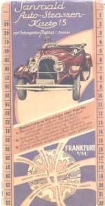
INo 2986 | 1920-1935 | Sanroald roadmap of Centre-Germany, opened 97x46cm, folded 11.5x23cm, very detailed register of the cities and villages between Euskirchen - Fulda - Luxembourg - Bad Mergentheim, around 1930, good condition | 10 € |
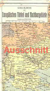
INo 1062 | 1939-1945 | Coloured German 'knapsack-map' of the European part of Turkey and their neighbour-countries, opens to 49x32cm, printed by GEA-edition about 1940, good condition with traces of use | 10 € |
INo 2306 | 1990-1990 | Streckenplan des FVV - Frankfurter- Verkehrs-Verbund, farbige Karte mit allen Bahn-, U-Bahn-und Bus-Linien, eine Seite Stadt Frankfurt mit Einzugsbereich, andere Seite Rhein-Main Region von Friedberg bis Darmstadt/Mainz bis Hanau, 30.09.1990, 30x42cm | 5 € |
INo 1794 | 1930-1950 | Walking map from about 1930, folding map on white canvas, showing German region Darmstadt, Heidelberg, with red marked ways, 47x33cm, very good condition | 15 € |
INo 3397 | 1946-1949 | Letter envelope, commercial produced in the German post- WW2 period, using the paper of a German pilots-map of Poland, 115x20cm, unused | 15 € |
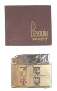
INo 13317 | 1955-1965 | US Penguin lighter, souvenir for US troops in Germany, around 1960, face showing German occupation zones and German Bundes-Eagle with 'Deutschland', back showing 4 Bavarian city crest, in orig. box and like new | 30 € |
INo 9931 | 1937-1956 | Map of Germany and bordering countries in borders of 1937, the after 1945 lost German areas marked, issued by the German Homeland Service Bonn March/April 1956, 51x42cm, good condition with traces of use | 10 € |
INo 9157 | 1900-1918 | Map of the German Franch War 1870/71, in German 'the battle for Spichern', lithograpy from around 1910 belonging to the book 'der deutsch-französische Krieg 1870/71', marking the frontlines and the camps of the troops, 69x55cm | 20 € |
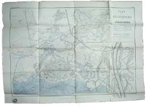
INo 9158 | 1900-1918 | Map, issued in Germany around 1910, explaning the German siege of Strassburg, showing position of German and French troops in German/French war 1870/71, 91x64cm, was supplement of book about that war | 20 € |
INo 9159 | 1900-1918 | German map 'Übersichtskarte 2. Aug. 1870', 3-colour-lithography, from book around 1910, 53x60cm, showing area Rehligen - Ottweiler - St. Avold - Saargemünd, French and Prussian frontlines German-French war 1870/71, | 20 € |
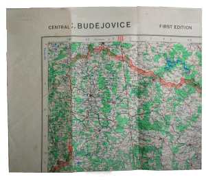
INo 14148 | 1944-1945 | US WW2 aeronautical map O49 'Budejovice', 'Budejovice' - Central Europe 1:250.000 of 1944, unsealed paper 88x65cm, Budejovice - Znojmo - Steyr - Modling Wien, very good condition | 20 € |
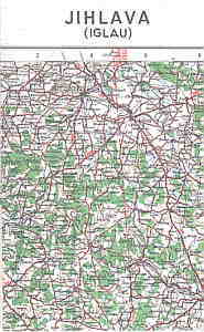
INo 11382 | 1943-1945 | US WW2 aeronautical map O52 'Jihlava - Iglau' - Central Europe 1:250.000 of 1943, dealing the Czechoslovakian area Zliw to Vysoke Mytoark, very good condition | 20 € |
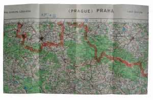
INo 14147 | 1944-1945 | US WW2 aeronautical map O51 'Schönau - Hohenfiedeburg - Prag - Chotzen' - Central Europe 1:250.000 of 1944, unsealed paper 88x65cm, very good condition | 20 € |
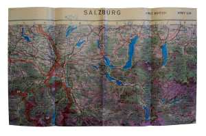
INo 14149 | 1943-1945 | US WW2 aeronautical map N48 'Salzburg' - Central Europe 1:250.000 of 1943, wax-paper 88x52cm, Jittenhart - Waldneukirchen - Prägraten - St. Lambrecht, very good condition | 20 € |
INo 14600 | 1925-1945 | German WW2 map, 33 pages 23x30cm with maps of Germany, Europe and world, geography, industry and statistics, missing cover, issued before 1938 and after 1920, used condition | 20 € |
INo 12744 | 1941-1945 | German map of the Asian battle fields and occupied zones from India to the Pacific on 4 single charts, 108x84cm, good condition | 15 € |
|
| |||